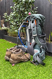


THE OLD CHALK WAY

Supposedly Great Britain's oldest highway this ancient trading route runs from Lyme Regis in the south west of England to Kings Lynn in Norfolk. The route constructed over 5,000 years ago to connect the south coast to the trading routes of the North Sea.
A couple of clever cyclists with time on their hands have now constructed a cycling route that ostensibly follows this ancient highway.
Although advertised as 574 km (356 miles) in length from start to finish, by the time you cycle from the nerest train station (Axminster) to the start at Lyme Regis and then cycle from the finish (Holme by Sea) back to the nearest train station
(Kings Lynn), and drift off course to find accommodation or food and drink along the way you will probably end up cycling 636 km (395 miles) which is what my total was.

A majority of the ride is off road with a split of approximately 65% off road and 35% on tarmac. To do it comfortably they recommened a mountain bike with at least front fork suspension. A gravel bike with big enough tyres (40mm or bigger) will also do the job. I used the latter. A MASON Bokeh Titanium framed gravel bike that has taken me on all my off road cycling journeys since 2020.

When the track is dry, its not an overly technical ride. You do want to be confident in your bike handling though as there are alot of rutted 4WD tracks and bumpy famers fields to navigate. In addition to some pretty steep downhill sections that you need to stay focused for. I discovered over the last 160 km when a recent storm had wet the track that the whole picture changes dramatically. You most definitely need to know what your doing. Especially when you spend the last 100km without a rear brake which is what befell me. More on that later.
Although the route constructors speak of ample replenishment opportunities on route, and an abundance of accommodation options, I found the route to be remarkably devoid of both. More often than not, a village that appeared on the route map, turned out to be nothing more than a hamlet of 4-6 isolated houses or a very small village. Neither with any ammenities. I had a romantic idea that I would be passing through villages every 10-15 km that would have at least one pub and/or one shop. Not the case. Especially in Dorset soon after you have left Lyme Regis. There were long stretches where I would be cycling 3-4 hours and not pass a single shop, pub or cafe. On one hand I found this strangely refreshing given how crowded Southern England is and yet on the other hand I found it bizzarely fustrating as I hadn't stocked up with food or drink in preapration for the isolation. The first 150km in particular when it was very hot and extremely hilly made for an interesting experience in starvation and energy management. Joy filled images of me sitting outside numerous pubs with a cold drink in hand and enjoying some decent grub remained exactly that. Images of my mind.
Lyme Regis sits on the Jurassic coast. Home to a many great fossils from the Jurassic period. The seaside town sits at the bottom of a series of hills with imposing cliffs fronting the sea. The town itself is pretty non descript and on the day I started it was a sea of humanity as an abnormally hot English summers day had driven the masses to find respite on the 'beach' and in the water . I put inverted commas there becuase by Australian standards, a waterfront of pebbles and stones does not make for a beach.
Lyme Regis

Lyme Regis

Lyme Regis ''beach"

Hills and cliffs do not make for an easy start to the ride. The freewheel down to the seaside was welcomed. The 9km climb out not so much.
Someone likened cycling in Dorset akin to cycling a massive upturned egg carton. I wouldn't disagree. On my navigational device it displays any categorised hill that your approaching. A categorised climb is any climb more than 500 meters in length and where the average gradient is higher than 5% . Well for the entire ride of 574km there are 19 categorised climbs on my device. 10 of them in the first 100km , 5 of them before you hit 150km and the remaining 4 before you get to half way. None from the half way point onwards.
Thankfully the climb out of Lyme Regis was on tarmac. Narrow country lanes though so it meant periodically pulling over and allowing over sized SUV's to pass. Once off the tarmac at the crest of the first hill the route throws you through a farmers yard and into a forest. And that remained the pattern for the rest of the day. Part tarmac but mostly off road . Some impossibly steep hills on loose gravel and a crumbling chalk base do not make for a happy Nick. Going downhill was not relaxing because given the roughness of the terrain it was very much grasping the handlebars and hanging on hoping that my spine didn't splinter from the constant jolting.
A more benign piece of the track that ran through a forest soon after I had crested the first hill of 9km

The benign nature didn't last long and for lengthy periods of the day I was cycling this...

The first hike-a-bike section occurred around 30km into the ride. Gravel so loose and stones so large it made forward progress difficult. My rule of thumb is generally that if I am cycling less than 4.5 kph I may as well get off and push because I can walk about that pace up a hill pushing a bike and that's more pleasurable for me and my back than trying to turn over the pedals.

By mid morning I was becoming surprised at the desolation of the route and lack of re-supply. For long periods I saw not a house, a person, or even a living animal.

Occasionally I'd find myself spat out of forests and woods and onto vast open spaces and a 4WD or tractor track that ran alongside farmed fields. Not alot of respite from the wind in these area's either.

Day 1 the lack of resources was having a profound impact on my state of energy and motivation. There was however no confusion as to why they called it the Old Chalk Way.

Around the 65km point I passed through Cerne Abbas. Home to one of the more phallic chalk hill engravings you are likely to see in the UK.


Cerne Abbas represented one of the few replenishment stops and it was most welcome. Not sure have ever devoured 2 pints of Coke and 3 sandwiches as quickly as I did this day. A picturesque little market village it warrants a longer look that I gave it.
The climb out of Cerne Abbas is a special one. Very steep, albeit on tarmac. So steep in fact that I found myself weaving horizontally across the road in order to maintain forward momentum.
No sooner had I crested the tarmc hill out of Cerne Abbaas than I was htrown out onto a farmers field. Here in the UK the public have certain rights of way and rather bemusingly you can find yourself travelling across what you would consider private land with total impunity.

I have included this photo simply because X marks the spot that I got a puncture. My tyres are tubeless. Meaning exactly that. They do not have inner tubes. Instead, there is liquid sealant that you pour into the tyre before sealing the tyre to the rim of the wheel. If a puncture occurs the sealant is pulled to the hole by the differential in pressure between inside the tyre and outside air pressure. Once in contact with air the sealant then solidifies and suppsoedly seals the hole. This does work effectively most of the time and in fact can be so efficient that on occasion you won't even know you have a puncture. However if the hole is large then a lot of sealant is required to seal the whole and may not be able to do all of the job. If this occurs and you are still losing air then its a case of dismounting the bike and inserting a plug into the hole. The plug itself has a copper arrowhead type point and a very small wax like runber tail of about 2-3 cm. You insert the arrowhead into the hole and the tail then seals the hole and in a way becomes part of your tyre. On this occasion, with this puncture, whatever it was that had penetrated the tyre was too large for just the sealant to deal with. So off the bike, insert a plug and hope it holds and you stop leaking air. It did. To a degree.

I love an English country road sign. The accuracy of the measurement has wlays bemused me. 10 1/2 or 3 1/4 . Not for the. English road distance measurers to round up or down to the nearest whole number.

Farmers fields were my companion for much of the first 100km

It wasn/t just open fields though and there were plenty of occasions when a single track and bramble or stinging nettles served to remind me I was alive.

This photo does the steepness of this hill NO justice whatsoever. Loose gravel and sizeable rocks do not make for easy grip regardless the size of your tyres. Climbing this particular hill was a decent work out in both a physical and mental sense.

Plenty of gates to open and close and I wanted to count how many I did in total throughout the ride but lost count after 15 in the first 100km.

The route itself seemed to be a meshing together of several already established walk ways. Not that I saw anyone actually walking on them in the first 100 km. Not a soul. Either walking or silly enough to be on a bicycle

Quintessential English scenes. Thatched roof houses and village churches.

Around 110 km into the ride you come into the town of Shaftesbury. Famous for really only one thing as far as I could ascertain. Which I guess is better than not being famous for anything. Gold Hill. There is an advertisement for an English bread called Hovis. The advertisement ran in the 1970's . In it, a mine in Lancashire is pushing his bike up an impossibly steep cobblestone laneway to his home where his wife has prepared a meal for him which includes a loaf of bread from Hovis. The theme of the advertisement I am guessing is that the reward for slaughtering yourself silly in a coal mine all day, and then having to push your bike up a lane because it is too steep is made worth it all by the reward of a loaf of Hovis bread. Well the hill in the advertisement is not in Lancashire. Rather it is in Dorset. Irrespective of its true location the hill is indeed steep; Not steep enough to stop a stubborn Nick from riding up it though.

Looking back down Gold Hill.

The main church in the village of Wilton on approach to Salisbury was impressive for several reasons. Quaint town, big well kept church, and the church itself was named St Nicholas.

The approach to Wilton was through a forest within a private estate. A wide open track way that was smooth and with an abundance of foliage to shield the cyclist from the elements. What was there not to like.

Around 155 km into the ride you get to one of the more significant archaeological sites in England. Stonehenge. When I first visited the stones back in 1990 you could walk close enough to them to touch them, and it was free. These days you're separated by two aspects. If you are willing to pay £27 you can walk inside a fenced off area that is relatively close but still behind a small rope . If you want to do the free option (my choice) you are guided to a track that runs around the outside of the fence. Oh, and if you want to visit the information centre then it is either a 20 min walk or a 10 min shuttle bus ride. All very bizarre.


On approach to Stonehenge and having successfully negotiated crossing the very busy A303 I was staggered at the number of campervans and caravans that lined the small country lane leading to the site. Numbering around 50 it was clear evidence of the allure of the attraction.
Shortly after leaving Stonehenge I found myself stopping in Larkhill to grab bite to eat. Basically it is a garrison for the British Artillery School. What was mildly interesting from a cultural point of view was my lunchtime destination. A cafe ran by three Muslim women. Adorned as they were in their Hijabs, I found it mildly intriguing that of all the places to set up business they had chosen a British Military town. They did do a great jacket potato with chips and by the looks of it the cafe was popular with the locals.
Leave Larkhill and you are soon within the boundary of the vast open fields of the main British Army firing range. Very very large wide and exposed land that is annoyingly undulating, and in the 3 times that I have ridden this area, seemingly always very windy. And always blowing a headwind regardless of the direction you are riding. The surface itself is gravel so descending one undulation after another commanded enough attention to keep you twitchy.
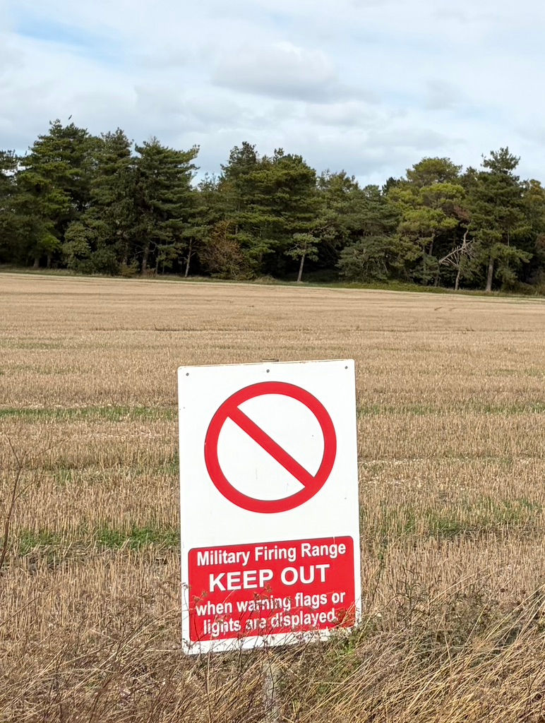
Despite the partly sunny look of the day that wind was both howling and cold. After an hour of riding into a block headwind and with still more undulation in front of me my mood had darkened somewhat. Not helped by the fact that the puncture I thought I had fixed with a plug was now slowly leaking air.

One very long undulating piece of terrain into a very strong headwind made this piece of the ride much much longer than it appeared on the map, and infinitely longer than I thought it would take me. Just as you crest one hill you can see 2-3 km ahead of you and all you see is more dips and rises than you'd care to see.

A deep rumble that appeared to be some way away suddenly appeared over the top of a crest and thundered on past me. Not even so much as a wave from the guy sat high up.

Again, little to no confusion as to why it's called The Old Chalk Way

Shortly after crossing the River Avon I stopped overnight at a cutely named hamlet called Honeystreet and took refuge at a pub canal side appropriately called The Barge Inn. Across the canal, and from one of the benches where I sat enjoyiong a cold beer I could see the famouse White Horse of Wiltshire.

Called The Barge Inn for a reason. Decent accommodation and decent grub too. There was a great cafe across the canal where a decent breakfast was enjoyed too.

Met a lovely Australian couple , Chris and Marion from Melbourne who were on a two week canal boating experience before heading to Italy for a wedding. Transpires her brother was a an Australian Rules Footballer of note. Like almost every other bike ride of distance I have done, the highlight is often the poeple you meet. This couple were no exception and it was an enjoyable evening.

As mentioned earlier, quite often you find yourself on famring land being worked or that appears to be private. On this particular monring the country lane had been closed to make way for a dairy farmer to load his herd of cows for transportation to somewhere.

Character cow.

The Avebury stones are in my opinion are more impressive historical site than Stonehenge.
They are a massive Neolithic henge and megalithic monument. Built between 2850 BC and 2200 BC, it features the largest prehistoric stone circle in the world.The Henge is a huge circular bank and a deep ditch nearly a mile in circumference that wraps around part of Avebury village. Whilst The Stone Circles are an outer circle originally holding about 100 massive sarsen stones (some weighing up to 100 tonnes) which encloses two smaller inner stone circles

Shortly after leaving Avebury and at about 205 km into the route you climb up onto what is called The Ridgeway. I have since renamed it ''The Up/Down Way''. I would be on this track for the next 140 km. You'd think given its name it runs atop a ridge. It doesnt. Probably about 50% is actually on a ridge line, the other 50% you are dropping into forests, small hamlets, across open fields and through small towns nowhere near a ''rdige''. You also want to be riding it, as thankfully I was, with the wind behind you. For there are plenty of exposed open sections where you are afforded zero protection from the elements.

When you were in fact atop the ridge line there were some pretty decent views of the Wiltshire countryside. I will give it that much.

Wish I had been around for this....

As I said...some lovely views from the ridgeline

You'll ride past a fair number of monuments too. This one in honour of Lord Wantage.

Eventually The Ridgeway takes you down to the Thames River where it passes through the picturesque town of Goring-on-Thames. Essentially marking the half way point of the entire ride.

No lack of tree roots either. Not quite on the same scale as those I had experienced earlier in the year in Papua New Guinea when doing the Kokoda Trail, but bothersome enough in their own way. Especially on a bike.


Plenty of entreprenurial farmers offering produce roadside in Berkshire.

Kopp Hill in Buckinghamshire was strangely not a categorised climb. Maybe it was the time of day that I did it, or perhaps the moon was in the wrong quarter, or I hadn't fed enough at lunch. Whatyever the reason I found it steep and difficult.

Cresting Kopp Hill and a few km's later at 310 km on route you will find yourself passing the gates of Chequers. Weekend retreat and countryside home for the PM of the UK.

A monument to ..Francis '3rd Duke of Bridgewater' - Father of in land Navigation and erected in 1832 he was also known as Lord Egerton. Transpires he was a pioneer of canal construction and was responsible for the building of The Bridgewater Canal. This monument was nowhere near any canal and stood upright in a national park at almost the end of The Ridgeway.

Coming off The Ridgeway you find yourself cycling reltively close to Whipsdale Zoo. They've taken advantage of the abundance of chalk for sure.

Passing through Dunstable and then Luton (neither of which are going to be my new home any time soon) the route takes advantage of another already established walking trail known as the Icknield Way.

Once past the commercial and industrial wastelands of Luton you find yourself back in countryside. Hertfordshire to be precise.

Crossing from Hertfordshire into Cambridgeshire you are basically in the bread basket of England. Vast stretches of very large wheat and rapeseed paddocks. Having being recently mucked and ploughed they certainly were aromatic.

It wasn't all Rapeseed and wheat though

The day was wet and cold, and nothing lifts the spirits more than cycling into a small town to discover a great cafe offering great coffee and even greater chocolate brownies.

Passing over the 400km point of the ride you're not far from Newmarket. The English town made famous for its horse racing and horse breeding fraternity. I was the tallest person in town by some margin.

Again, at this point, and just near Thetford the route picks up The Peddars Way. From this point onwards to the finish this will be your guiding track. Not a lot of fun to cycle, especially in the wet. Cannot imagine much fun to walk either as the scenery wasn't anything special and there is a distinct lack of villages.

Not a lot of fun to cycle because around Thetford its base is no longer chalk but a very soft glue type sandy base. Here there was enough sand to get flicked up into my rear brake caliper thereby rendering my rear brakes useless and so it was onto the finish some 100km away without a rear brake.

Thetford is the birthplace of Thomas Paine. An English-born American inventor, political philosopher, and statesman. who authored Common Sense (1776) and The American Crisis (1776).

Once into the last 100km and north of Thetford the Peddars Way does have sections which were reasonable to ride. Especially as the rain had ceased.

It (Peddars Way) did cross some picturesque brooks / creeks.

Transpires that during the second world war the British government commandeered land in the area and basically got 3 villages vacated so they could use the land for military purposes during the war. They did so on the promise they would give back the land to the villagers once the war had finished. They never did.

Great Cressingham. My final stop and some 80 km from the finish.

Another monument in the middle of nowhere.

Having experienced a sub standard meal at the pub I stayed at on the last night I wasn't prepared to chance my arm at breakfast. Instead I rode 10km and stumbled across a Macdonalds. I cannot recall the last time I walked into one of these places. I think it was Italy somewhere on route to Rome. Suffice to say it did the job this particular day. Pancakes in particular were pretty good.

The final day had started with a heavy fog but was starting to open up in to a lovely weather day.

Did I mention the fog? Atmospheric.

Peddars Way is a quagmire in the wet and the recent days storm had left the track with an abundance of mud and puddles. All a lot of fun to negotiate with only my front brake . Especially going downhill.

The last 10km of the ride is along tarmac and across the flat lands of Northern Norfolk.

The finish is at Holme by Sea. Supposedly another 'beach'. On this occasion I couldn't even see the water. Out there in front of me is what they call The Wash.

If there was any doubt I had come to the end of the line.

Once you have cycled to the finish there is the small matter of getting home. If you don't have someone picking you up then you are faced with doing a U-turn and cycling back 33 km to Kings Lynn to catch the train. You will pass the gates of The Kings Weekender , Sandringham Estate, along the way. And to ease your pain there is a designated cycling route for that final 10km from the estate to Kings Lynn. Also known as National Cycle Route 1.

You will also cycle past another appropriately named church.

Then its the delight of 2 hours and £45 to get the train from Kings Lynn to Kings X in London. A cycle across London in peak hour to Waterloo station and then another train to Twickenham before the final 1 km ride home.

Comments